Highlights:
- Ignacio was downgraded to a tropical storm Tuesday night and was located several hundred miles north of the Hawaiian Islands.
- The center of Ignacio will remain well north of Hawaii through midweek.
- Dangerous surf and rip currents will continue to affect the east-facing shores of Hawaii through midweek. High surf warnings have been issued by the National Weather Service until Thursday evening.
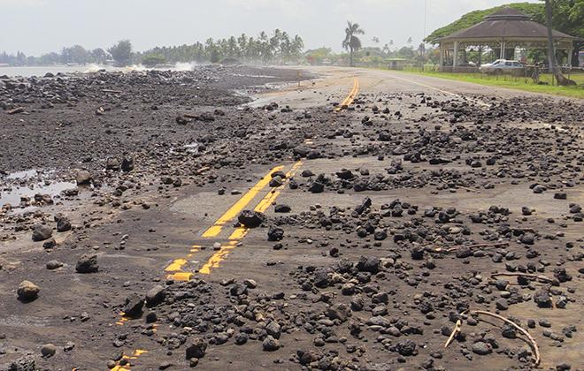
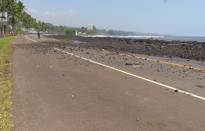
- Swells from Ignacio have pushed sand and other debris onto some beaches and roadways on the Islands.
- At one point Saturday evening into Sunday morning, Ignacio was one of three Category 4 hurricanes in the Pacific, joined by Kilo and Jimena.
Latest Storm Information
Ignacio reached its peak intensity as a Category 4 hurricane this past weekend and is now weakening.
(MAP: Follow Hurricane Ignacio with our new Interactive Storm Tracker)
The weakening trend will continue over the next few days as it moves north of the Hawaiian Islands and is due to an increase in wind shear and slightly cooler water temperatures. The increase in wind shear is thanks to the proximity of the subtropical jet over the Hawaiian Islands. As Ignacio gains latitude, it will likely face increased shear, which tends to push convection away from the center of tropical cyclones.
Surf generated by Ignacio washed up sand and debris & closed beaches across the state http://808ne.ws/1PK6ScU #hiwx
Several tropical systems have threatened Hawaii over the past few weeks, but most of them changed course and/or weakened before directly impacting the islands.
Climatologically speaking, virtually all hurricanes near the Hawaiian Islands since 1950 have approached from the southeast, south or southwest. Those approaching from the east tend to either weaken quickly or shift north of the islands. Iselle in 2014 was one notable exception, however.
(MORE: Hawaii's Hurricane History)
Projected Path


No comments:
Post a Comment