November 16,2013
More than 5,000 people have been evacuated from towns and villages in North Sumatra's Karo Regency since Mount Sinabung awoke in October after a three-year dormancy. Karo is an agricultural region that supplies vegetables for surrounding islands. The evacuation and devastating ash fall have affected crop harvests, leading to higher prices on vegetables and chilies elsewhere in Indonesia, according to the Jakarta Post.
(MORE: Severe Weather Outbreak Possible)
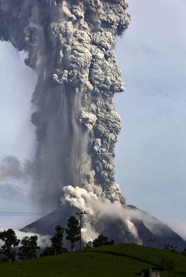
Mount Sinabung spews pyroclastic smoke as seen from Tigapancur
village in Karo district on November 14, 2013 in Medan, Sumatra,
Indonesia. (Getty/Ulet Ifansasti)
On Monday (Nov. 11), a pyroclastic flow, a fast-moving avalanche of ash, lava fragments and air, was seen racing down the peak. Since then, the volcano has blasted out one to two ash explosions every day. Lava has flowed more than 1,000 meters (3,200 feet) from the top of the volcano. [Watch Mount Sinabung erupt]
Indonesia lies in the Pacific "Ring of Fire," an area of crustal collision zones that is the cause of a great number of earthquakes and volcanoes. The island nation has more than 130 active volcanoes. The world's most deadly volcanic eruption in recent years was at its Mount Merapi in 2010, which killed more than 350 people.
- Big Blasts: History's 10 Most Destructive Volcanoes
- Amazing Images: Volcanoes from Space
- The World's Five Most Active Volcanoes
Mount Sinabung Erupts in North Sumatra, Indonesia
Bitter harvest: Indonesia volcano damages crops, forces thousands to flee http://nbcnews.to/1j9eCnu
NBC News ✔
@NBCNews
Follow
Photos: Indonesia volcano damages crops as it coats fields in ash, forces thousands to flee http://nbcnews.to/HV9tnB
Copyright 2013 LiveScience, a TechMediaNetwork company. All rights reserved. This material may not be published, broadcast, rewritten or redistributed.


 Bitter harvest: Indonesia volcano damages crops, forces thousands to...


No comments:
Post a Comment