Sunday, February 5, 2017

This Date in Weather History for February 5,2017 from weatherforyou.com

Weather History
For Sunday,February 5,2017


1887 - San Francisco experienced its greatest snowstorm of record. Nearly four inches was reported in downtown San Francisco, and the western hills of the city received seven inches. Excited crowds went on a snowball throwing rampage. (David Ludlum)
1987 - Thunderstorms in the Southern Plains Region caused flooding in parts of south central Texas. Del Rio TX was soaked with two inches of rain in two hours prior to sunrise. (The National Weather Summary)
1988 - Cold and snow invaded the southern U.S. Roswell NM was buried under 16.5 inches of snow in 24 hours, an all-time record for that location. Parts of the Central Gulf Coast Region reported their first significant snow in fifteen years. Strong winds in Minnesota and the Dakotas produced wind chill readings as cold as 75 degrees below zero. (The National Weather Summary) (Storm Data)
1989 - Severe cold gripped much of the nation. Thirty cities reported new record low temperatures for the date. Morning lows of 9 above at Astoria OR and 27 below zero at Ely NV were records for February. In Alaska, Point Barrow warmed to 24 degrees above zero, and Nome reached 30 degrees. (The National Weather Summary)
1990 - For the second time in two days, and the third time in a week, high winds plagued the northwestern U.S. Winds in Oregon gusted to 60 mph at Cape Disappointment, and wind gusts in Washington State reached 67 mph at Bellingham. The first in a series of cold fronts began to produce heavy snow in the mountains of Washington and Oregon. Ten inches of snow fell at Timberline OR. (The National Weather Summary) (Storm Data)
2006 - Mount Washington Observatory in New Hampshire reaches a high of 41°F, the warmest February 5th on record at the summit and two degrees off the monthly mark, where records have been kept since 1932. The Weather Doctor
2008 - The deadliest round of tornadoes in nearly a quarter century kill 58 people in the south. The storms kill 32 people in Tennessee, 14 in Arkansas, seven in Kentucky and five in Alabama. Damage is likely to be in the hundreds of millions of dollars. The Weather Doctor
2010 - A mega-snowstorm, which President Obama dubbed Snowmageddon, buried the Washington D.C. area with more than 30 inches of snow in some areas. At American University in Washington the official snowfall was 27.5 inches. Snowfall totals in the Washington DC area range from a low of 17.9 inches at Ronald Reagan National Airport to 40 inches in the northern suburb of Colesville, MD. Dulles Airport reported 32.4 inches, which established a new two-day snowfall record. The Baltimore-Washington International Airport, MD, measured 24.8 inches from the storm breaking the record for the largest two day snowfall there. It is one of the worst blizzards in the city's history.

Saturday, February 4, 2017

Damaging winds to whip across France and Spain through Sunday

By Eric Leister, AccuWeather meteorologist
February 4,2017, 10:21:36AM,EST
 
 
Another round of damaging winds and heavy rain will lash France, Spain and northern Portugal on Sunday as the parade of storms from the Atlantic Ocean continues.
Locations across northern Spain as well as western and southern France will be at the greatest risk for travel disruption as powerful winds howl each day through Sunday.
The strongest wind will occur along the coast of the Bay of Biscay on Sunday morning. These strong winds will then shift to the southern coast of France and the Mediterranean during the afternoon. The strongest of the winds will pass to the south of Paris.
2/4 Wind
In coastal locations of western France and northern Spain, wind gusts could reach 130 km/h (81 mph) during the height of the storm. Winds of this magnitude can result in widespread power outages and damage to trees and homes.
"The winds can ground planes for a time and knock over high-profile vehicles," AccuWeather Senior Meteorologist Kristina Pydynowski said.
Strong winds will also lash Madrid. Gusts of 65 to 80 km/h (40 to 50 mph) will occur with higher gusts in the mountains to the north of the city.
"Sunday is likely to be the windiest day of this stormy pattern for central and eastern Spain," Pydynowski said. "Wind gusts of 80-100 km/h (50-60 mph) threaten to cause power outages and tree damage from Zaragoza to Lleida, as well as in Murcia and Barcelona."
Related:
France Weather Center
Western Europe Weather Radar
Spain Weather Center

Along with the threat for damaging winds, wind-driven rain will soak much of Spain and France as well.
The greatest threat for flooding will be across northern Spain and southern France where rainfall totals, starting with the rain that arrived on Thursday night, of 75-150 mm (3-6 inches) will be common with local amounts exceeding 200 mm (8 inches).
Locations in western and central France can expect 25-75 mm (1-3 inches) of rain through Sunday, prompting localized flooding.
2/4 storm

"Heavy snow, totaling more than a half of a meter (2 feet) will bury the peaks of the Pyrenees this weekend with substantial snow also developing over the mountains of northwestern Spain on Sunday," Pydynowski said.
“These storms will also bring a high risk for coastal flooding, especially during high tide,” said AccuWeather Meteorologist Tyler Roys.
“Dangerous seas will persist across the Bay of Biscay through Sunday with waves over 9 meters (30 feet) at times,” Roys added.
Additional unsettled weather is expected across France and Spain next week. However, the threat for damaging winds and flooding will lessen.

UK to face additional heavy rain, strong winds on Monday

By Kristina Pydynowski, AccuWeather senior meteorologist
By Adam Douty, AccuWeather meteorologist
February 4,2017, 9:45:57AM,EST
 
 
After a lull through Sunday, the risk of damaging winds and wind-swept rain will return to the United Kingdom to start the new week.
Following the departure of the storm that crossed the U.K. on Friday and into the start of the weekend, the storm track will shift farther to the south for Sunday.
While odd showers will dampen some communities across the north of the United Kingdom, the British Isles will escape the heavy rain and damaging winds targeting France, Spain and northern Portugal.
2/4 UK Sunday
Beyond this weekend, the storm track will shift back to the north and lead to a much stormier spell across the U.K. early in the new week.
"A strong cold front will blast across Northern Ireland, Scotland, southwestern England and Wales on Monday," AccuWeather Meteorologist Rob Richards said. "This will cause a period of steadier and heavier rain, along with strong wind gusts of 50-60 mph (80-100 km/h)."
RELATED:
United Kingdom weather center
MinuteCast® for your location
Interactive United Kingdom weather radar

Even stronger gusts, ranging on the order of 60-70 mph (95-112 km/h), may blast the Hebrides of Scotland and the Orkney and Shetland islands.
Scattered power cuts and tree damage can result, as well as disruptions to rail, air and ferry services. This includes in Belfast, Glasgow and Plymouth.
2/4 UK Monday

The front will continue to advance eastward with the majority of the rain reaching eastern England, including London, on Monday night. Winds will not be as strong as across southeastern Britain, but there can still be gusts between 35 and 40 mph (55 and 65 km/h).
The winds will make holding onto brollies very difficult.
The rain accompanying the front across the U.K. on Monday and Monday night is not anticipated to cause widespread flooding with rain totals largely remaining under 25 mm (an inch). However, any downpours could lead to slower travel as motorists would be faced with reduced visibility and a heightened risk of vehicles hydroplaning.
Scattered showers, which can turn wintry in the hills, will follow Monday’s front on Tuesday.
Colder air from Scandinavia should then spread across the U.K. at midweek. While frosty nights should unfold, the cold may work to prevent a storm set to arrive around Thursday from making too much eastward progress across the U.K.

March-like warmth returns for Super Bowl Sunday along with showers

By Courtney Spamer, AccuWeather meteorologist
February 4,2017, 2:14:03PM,EST


“On Sunday, the mercury will be rising through the 60s and into the 70s in the Houston area,” said AccuWeather Meteorologist Steve Travis.
“The afternoon high in the upper 70s will have it feeling more like late March, about 15 degrees Fahrenheit above normal for early February.” Travis added.
SuperBowl-Feb4
Although the temperatures will be comfortable for playing and watching football, the chance for wet weather on Sunday will threaten to close NRG Stadium’s retractable roof.
The league will make the call about leaving the roof open sometime on Saturday, Feb. 4, on whether or not to keep the roof open, according to NFL director of events, Eric Finkelstein.
Luckily inclement weather will not pose a threat to the quality or outcome of the game due to the roof. However, the spotty shower across the area could dampen the festivities in and around the stadium.
“Although much of the day will be dry, there will still be a few brief showers around throughout the day in Houston,” said Travis.
One of the biggest activities into Sunday afternoon is Super Bowl Live, a free fan festival that will be held at Discovery Green, a 12-acre park in downtown Houston. Those running around in the park could see one of these showers.
RELATED:
Houston weather radar
MinuteCast for NRG Stadium
Weekly Wrap Up: Phil declares 6 more weeks of winter; California officials record highest Sierra snowpack in 22 years

Those going to the Players Tailgate at Mike Calvert Toyota before the game could also be dodging showers.
For the evening, there could be a lingering shower or two, but overall it is expected to stay mainly dry. For spectators and fans heading home after the game, it will still be mild with temperatures in the upper 60s.
Those leaving the Houston area on Monday or Tuesday after the game should have little in the way of weather-related travel problems. Eastern Texas will continue to have March-like temperatures with just a spotty shower or thunderstorm each day.

Another round of snow, rain to snarl travel in the Pacific Northwest this weekend

By Kyle Elliott, AccuWeather meteorologist
February 4,2017, 6:47:16AM,EST
 
 
A pair of winter storms will bring additional rounds of rain and snow to storm-weary residents of the Pacific Northwest this weekend.
The first in the series will be a continuation of the storm that paralyzed Portland, Oregon, with freezing rain into Friday, causing numerous accidents and resulting in the closure of portions of Interstate 5.
Though wet weather will persist on Saturday, travel conditions in the Interstate-5 corridor between Seattle and Portland will vastly improve as temperatures rise well into the 40s.
In the higher elevations, however, snow may snarl travel in the Cascades of Washington and northern Oregon, as well in the Bitterroots of Idaho.
Motorists venturing across Interstate 90 between Missoula, Montana, and Snoqualmie Pass, Washington, should reduce speeds when driving through heavy snow.
Feature graphic hd11

The second storm is set to follow on Saturday night through Monday morning, bringing an even heavier bout of wintry weather to the Northwest.
As colder air charges into the region on Sunday night, rain along the I-5 corridor between Seattle and Portland will quickly changeover to heavy, wet snow.
“Snowfall accumulation Sunday night between the I-5 corridor and the Cascades from northern Oregon to Washington will depend on elevation,” according to AccuWeather Meteorologist Michael Doll.
While the city of Seattle will pick up only a couple of inches of snowfall, areas just east of the city could receive more than 6 inches, Doll added.
Seattle averages just under 6 inches of snow in a typical winter season. Even a few inches of snow at one time can cause travel delays and shut down major roadways.
Motorists should be prepared for possible road closures from Sunday night into Monday.
Related:
Wintry weather to continue across US into March
Check the AccuWeather MinuteCast® for Portland, Oregon
AccuWeather Winter Weather Center

Additionally, the weight of the snow may bring down power lines and cause tree branches to snap.
“Areas that receive more than 4 inches of snow are at risk for power outages,” Doll stated.
While wet snowflakes may be sighted in Portland on Sunday night, mostly rain is expected over the weekend as temperatures remain well above freezing.
Another 1 to 2 feet of additional snow will bury the Cascades and the Bitterroots through Monday, with over 6 inches expected in portions of the I-5 corridor in southern Washington.
Major airline delays are likely throughout the Northwest as visibility is greatly reduced in the rain and snow.
A brief reprieve from the stormy conditions will arrive on Monday evening.

Storms pose double-edged sword to California: Flooding, mudslides vs. drought relief

By Alex Sosnowski, AccuWeather senior meteorologist
February 4,2017, 2:35:55AM,EST
 
 Additional rounds of rain and mountain snow will cause more travel problems, but will also bring more drought relief to California into much of next week.
The large storm that rolled ashore this past week will weaken.
"Areas of rain, ice and snow will retreat northward and diminish in coverage area over the northwestern United States this weekend," according to AccuWeather Meteorologist Alyson Hoegg.
However, at least three more rounds of moisture will be flung at California from the Pacific Ocean next week.
More storms, travel problems in store next week
Each storm has the potential to renew the risk of flash flooding and mudslides, especially in urban and recent burn areas.
One potent storm system is scheduled to roll ashore from the Pacific Ocean at the tail end of the weekend and continue into early next week.
Static Cali Ore Sun Night Monday storm

Rain will first push into western Oregon and northernmost California later Sunday. Next, the rain will expand southward through central California and parts of Southern California during Sunday night and on Monday.
"Heavy rain will fall from the central and northern coast of California to the Central Valley," Hoegg said. "Drenching rain will also reach the Los Angeles Basin."
Enough rain accompanied by a low cloud ceiling and fog will cause airline delays to expand southward across the state during late Sunday to Monday.
Motorists should anticipate a wet and slow commute over much of the state on Monday.
RELATED:
Weekly wrap-up: Phil declares 6 more weeks of winter; California officials record highest Sierra snowpack in 22 years
Vehicles and semi-trucks collide in major crashes along icy I-5 in Portland, Oregon
100 million dead trees in California add fuel to wildfire debate

Heavy snow will again fall over much of the Sierra Nevada with each storm.
While snow levels will vary with each storm, "a few more feet of snow will fall over the central and northern Sierra Nevada at elevations generally above 6,000 feet," Hoegg said.
Motorists who plan on venturing over Donner Pass should be prepared for wintry conditions and possible road closures from time to time through next week.
Snow levels will remain above the passes in Southern California with the storm on Monday.
"Another storm is slated to roll in from the Pacific on Tuesday, followed by a third storm toward the end of the week," according to AccuWeather Senior Meteorologist Brett Anderson.
Static storms return to West

"Rain and mountain snow from the latter two storms will focus on central and northern California, rather than areas farther to the south," Anderson said.
Ongoing storms to further boost drought relief
In addition to the potential for renewed flooding and mudslides, rain and snow from the storm will likely shave another layer of drought intensity off Southern California by late next week.
Storms to date have wiped out the drought in northern California and have significantly reduced the drought farther south, according to the United States Drought Monitor. Only a small part of Southern California between Santa Barbara and Los Angeles remains in extreme drought as of Tuesday, Jan. 31, 2017.
This season to date, rainfall has already had a great positive impact on many reservoirs in California, according to KQED.
The rain has filled some reservoirs to the point where water is now being released downstream.
Static AP Briones Reservoir Jan. 11, 2017
In this Wednesday, Jan. 11, 2017, photo, Briones Reservoir is seen near capacity in Orinda, Calif. Inches of additional rain has fallen on the state since the middle of January with more on the way into early February. (AP Photo/Ben Margot)

Even if the snow and rain were to suddenly shut off for the rest of the season, there is enough snow over the high country to continue to ease the drought moving forward this year.
As of Jan. 21, the Sierra Nevada has received the biggest seasonal snowfall since the mid-1990s with more on the way.
As the snow gradually melts this spring and summer, it will be released into area lakes, reservoirs and aqueducts.
Static Cali Rain Benefits

While some of the storms thus far have been heavy enough to close roads and raise the risk of avalanches, the snowfall so far this season has helped to boost skiing interest in the region.
While the storm track will again shift northward toward the middle of February, a few more storms may come calling later in the month.

Vehicles and semi-trucks collide in major crashes along icy I-5 in Portland, Oregon

By Kevin Byrne, AccuWeather staff writer
February 4,2017, 2:52:00AM,EST
 
Numerous accidents were reported around the Portland, Oregon, area Friday morning as freezing rain slicked major roadways.
Portland Fire and Rescue crews responded to multiple accidents on Interstate 5 amid icy conditions.
Officials recommended that a stretch of southbound I-5 near the Capitol Highway be shut down after as many as 50 vehicles were involved in an accident. Semi-trucks and cars were both involved in the accident.
oregon_ice_accident
(Photo/Oregon Department of Transportation)

The Oregon Department of Transportation (ODOT) urged motorists to delay their morning commute if possible until conditions improve.
ODOT also said it was applying sand and a deicer product to the road as it worked to clear the accidents. As of 5:30 a.m. PST, a stretch of I-5 had already begun to reopen.
Several minor injuries were reported across all crashes, KATU in Portland reported.
Several TriMet buses were requested to shelter stranded drivers who were stuck in the cold. Significant delays to rail and bus services were also reported.
The precipitation first moved into the region around 1:30 a.m. local time Friday and will continue through Saturday.

Temperatures hovering around freezing have allowed slippery conditions on elevated and untreated surfaces, in particular, to continue into Saturday morning as intermittent bouts of freezing rain have continued.
"The threat for freezing rain will finally end by Saturday morning as temperatures rise above freezing," according to AccuWeather Storm Warning Meteorologist Alex Avalos.
 

This Date in Weather History for February 4,2017 from weatherforyou.com

Weather History
For Saturday,February 4,2017


1961 - The third great snowstorm of the winter season struck the northeastern U.S. Cortland NY received 40 inches of snow. (David Ludlum)
1987 - Gales lashed the northern Pacific coast and the coast of northern New England. A storm in the central U.S. produced five inches of snow at Rapid City SD. (The National Weather Summary)
1988 - A winter storm produced heavy snow from the Upper Ohio Valley to New England, with up to 12 inches reported in Vermont and New Hampshire. Strong northerly winds in the Upper Midwest produced wind chill readings as cold as 60 degrees below zero. (The National Weather Summary) (Storm Data)
1989 - Two dozen cities in the south central and northwestern U.S. reported new record low temperatures for the date. The low of 14 below zero at Boise ID was a February record. A winter storm continued in the southwestern U.S. Alta UT reported 49 inches of snow in four days, Wolf Creek CO reported 66 inches in six days, including 28 inches in 24 hours, and up to 84 inches buried the ski resorts of northern New Mexico in three days. (The National Weather Summary) (Storm Data)
1990 - A winter storm produced heavy snow in the northeastern U.S. Snowfall totals in Maine ranged up to 13 inches at Gorham, with 11 inches reported at Portland. Totals in New Hampshire ranged up to 14 inches at Franconia, with 13 inches reported at Portsmouth. A mixture of snow, sleet and freezing rain caused numerous traffic accidents in eastern New York State resulting in three deaths and fourteen injuries. Subzero cold also gripped parts of the northeastern U.S. Caribou ME and Houlton ME reported morning lows of 15 degrees below zero. (The National Weather Summary) (Storm Data)
2004 - 7.15 inches of rain deluges Pinson, AL, setting an all-time record rainfall over 24 hours for the town. The Weather Doctor
2007 - Kahului reports a minimum temperature of 54°F, a daily low temperature record for the date. The Weather Doctor

Friday, February 3, 2017

Psychology of warnings: Why do people ignore important weather alerts?

By Chaffin Mitchell, AccuWeather staff writer
February 3,2017, 11:35:08AM,EST
 
 In a time where technology and meteorology are very precise, psychologists and meteorologists are working together to evaluate better warning systems.
Dr. Laura Myers, director and senior research scientist at the Center for Advanced Public Safety, who studied warnings and how people react to them, said people have a tendency to not want to change plans or their behavior for weather unless they are fairly sure the weather is going to impact them.
Myers said people get desensitized to watches and warnings after so many don’t produce any impacts for their specific area.
“Improvements in the warning process are addressing these issues and providing more specific geolocations and more lead time when possible,” Myers said.
Alert notifications that are targeted to an exact location and provide more lead time to help people react better. Also, warnings with potential impacts and calls to actions help people better respond to threatening weather.
“When people hear what the weather impacts are, such as damage and destruction to well-built homes, they start to pay attention. When they are told they need to take shelter now because their location is going to take a direct impact, they usually act,” Myers said.
The word emergency, such as a tornado emergency or flash flood emergency, tends to get the attention of people, Myers said.
Psychology of warnings: Search & rescue
Rescue workers search inside a mobile home, Monday, Jan. 23, 2017, in Big Pine Estates that was damaged by a tornado, in Albany, Ga. Fire and rescue crews were searching through the debris Monday, looking for people who might have become trapped when the storm came through. (AP Photo/Branden Camp)

The time a warning is issued to the public can also make a difference in response. When people are given too much lead time, they can get tired of waiting and tend to go back to their business, Myers said.
“That’s why we have to be careful giving too much information several days out from an event. There is a real communication process involved in the sequencing of information in the days and hours leading up to an event,” Myers said.
Regardless of the warning, some people wait until they see their life is in danger.
“A lot of social media research was done and people said they have to see [a tornado] before they do something,” AccuWeather Meteorologist Dan Kottlowski said.
Mike Smith, Senior Vice President of AccuWeather Enterprise Solutions and author of Warnings: The True Story of How Science Tamed the Weather, said there are many reasons why people wait to react.
"There is considerable inertia in people. They are busy or their attention is on some project. There is also sociological evidence that people feel silly for taking shelter; that it somehow reflects poorly on their courage," Smith said.
He said in order to get people to take shelter or evacuate, it seems warnings need to come from someone they trust. Receiving the warning from more than one source can also help, Smith said.
“We try to issue the warnings very early now so they take cover, but people need to see that something’s coming at them,” Kottlowski said.
RELATED:
Be AccuWeather Ready ahead of any dangerous weather
The difference between tornado watches and warnings
Students barely escape Hattiesburg tornado

Therefore, Kottlowski said they have started enhanced warnings, which are warnings with amplified wording like severe and imminent danger.
"Not all warnings have enhanced wording, it's only when we have a situation when we have a big tornado already causing damage," Kottlowski said.
Meteorologists and psychologists are looking at more than just the wording.
“Psychologists are working with meteorologists to come up with an understanding of why people are just not adhering to the warnings, maybe it’s a combination of wording and graphics,“ Kottlowski said.
Kottlowski said radars don't make sense to some people, so there needs to be a simple graphic that will show were the most dangerous impacts of the severe weather will occur.
search and rescue
A sign declaring a mandatory evacuation in anticipation of the arrival of Hurricane Irene is seen as motorists head north in Nags Head, N.C., Thursday, Aug. 25, 2011 on North Carolina's Outer Banks. (AP Photo/Charles Dharapak)

However, broadcasters are able to explain radars to people in a simple, urgent manner.
"The really good television meteorologists have mastered the art of using tone of voice and other cues to persuade people to take action when they are convinced a really dangerous storm is occurring or imminent," Smith said.
That will still not solve the problem entirely, experts agree.
“When you get a really bad outbreak where you have multiple tornadoes moving very quickly, you are still going to have a lot of fatalities and injuries because people aren’t going to be able to get out quickly enough,” Kottlowski said.
Technology, meteorologists and psychologists are making immense improvements and progress to help save the lives of people across the globe.
“The goal is to communicate weather information to an educated public who knows what to do when the time comes,” Myers said.


John S Lynn ·
I do not pay attention to weather warnings because they are too many for too little. Warnings flashing and sounding on every type of media for a week and then we get 1 inch of snow. One inch of snow in New York is a weather forcast, not a warning. Alerts and warnings for 30 mph wind is also a forcast not a warning, a warning is 60 mph or higher winds. I had to delete Accuweather and Weatherbug from my phone because all day several times a week while I was at work they would be screaming and flashing at me about a light drizzle, a snow flake, or a cloud going by.
Like · Reply · 1 · 3 hrs
Bill Smith
Perhaps, People ignore the warnings because weather forecasters have a high percentage of inaccurate forecasts, and do not admit it. Also many large storm forecasts even if the storm does hit as predicted are not as severe as the forecast and newscasters predict. Over forecasting, and completely wrong forecasting without explanation is causing many people to disregard important storm forecasts as they believe they can get by without help.
Like · Reply · 1 · 4 hrs
Ivar Husa · I expect that our 'spatially aware' (GPS) cell phones will enable more location-specific warnings that could carry the greatest 'weight' (importance) with citizens potentially in the path of dangerous weather.

Damaging winds to whip across France and Spain into this weekend


By Eric Leister, AccuWeather meteorologist
February 3,2017, 4:53:03PM,EST
 
 
Additional rounds of damaging winds and heavy rain will lash France, Spain and northern Portugal this weekend as the parade of storms from the Atlantic Ocean continues.
Locations across northern Spain, northern Portugal and western and central France will be at the greatest risk for travel disruption as powerful winds howl each day through Sunday.
The one exception will be across the Brittany region of northwestern France, where there will be less wind on Saturday as the next storm blasts into France farther to the south. How far north the following storm tracks on Sunday will determine whether the region will endure another round of strong winds to end the weekend.
The windiest period for Paris will be on Friday evening, but periods of rain will follow for this weekend as the damaging wind risk takes aim at communities to the south.
Wind gusts Feb 3
In coastal locations in western France, northern Spain and northwestern Portugal, wind gusts could reach 130 km/h (81 mph) during the height of the storms. Winds of this magnitude can result in widespread power outages and damage to trees and homes.
"The winds can ground planes for a time and knock over high-profile vehicles," AccuWeather Senior Meteorologist Kristina Pydynowski said.
Strong winds will also lash Madrid this weekend. Gusts of 65 to 80 km/h (40 to 50 mph) will occur each day with higher gusts in the mountains to the north of the city.
"Sunday is likely to be the windiest day of this stormy pattern for central and eastern Spain," Pydynowski said. "Wind gusts of 80-100 km/h (50-60 mph) threaten to cause power outages and tree damage from Zaragoza to Lleida, as well as in Murcia."
Related:
France Weather Center
Western Europe Weather Radar
Spain Weather Center

The higher terrain to the west should work to shelter Barcelona from the strongest winds, but there can still be gusts between 65 and 80 km/h (40 and 50 mph).
Along with the threat for damaging winds, wind-driven rain will pound the same communities this weekend.
The greatest threat for flooding will be across northern Portugal and northwestern Spain where rainfall totals, starting with the rain that arrived on Thursday night, of 75-150 mm (3-6 inches) will be common with local amounts exceeding 200 mm (8 inches).
Locations in western and central France can expect 25-75 mm (1-3 inches) of rain through Sunday, prompting localized flooding.
Storm Train Feb 3

"Heavy snow, totaling more than a half of a meter (2 feet) will bury the peaks of the Pyrenees this weekend with substantial snow also developing over the mountains of northwestern Spain on Sunday," Pydynowski said.
“These storms will also bring a high risk for coastal flooding, especially during high tide,” said AccuWeather Meteorologist Tyler Roys.
“Dangerous seas will persist across the Bay of Biscay through Sunday with waves over 9 meters (30 feet) at times,” Roys added.
Additional unsettled weather is expected across France and Spain next week. However, the threat for damaging winds and flooding will lessen.

Vehicles and semi-trucks collide in major crashes along icy I-5 in Portland, Oregon

By Kevin Byrne, AccuWeather staff writer
February 3,2017, 11:55:17AM,EST
 
 Numerous accidents were reported around the Portland, Oregon, area Friday morning as freezing rain slicked major roadways.
Portland Fire and Rescue crews responded to multiple accidents on Interstate 5 amid icy conditions.
Officials recommended that a stretch of southbound I-5 near the Capitol Highway be shut down after as many as 50 vehicles were involved in an accident. Semi-trucks and cars were both involved in the accident.
oregon_ice_accident
(Photo/Oregon Department of Transportation)

The Oregon Department of Transportation (ODOT) urged motorists to delay their morning commute if possible until conditions improve.
ODOT also said it was applying sand and a deicer product to the road as it worked to clear the accidents. As of 5:30 a.m. PST, a stretch of I-5 had already begun to reopen.
Several minor injuries were reported across all crashes, KATU in Portland reported.
Several TriMet buses were requested to shelter stranded drivers who were stuck in the cold. Significant delays to rail and bus services were also reported.
The precipitation first moved into the region around 1:30 a.m. local time and continued through the overnight hours. However, the city will see a break in the wintry conditions for a time on Friday.
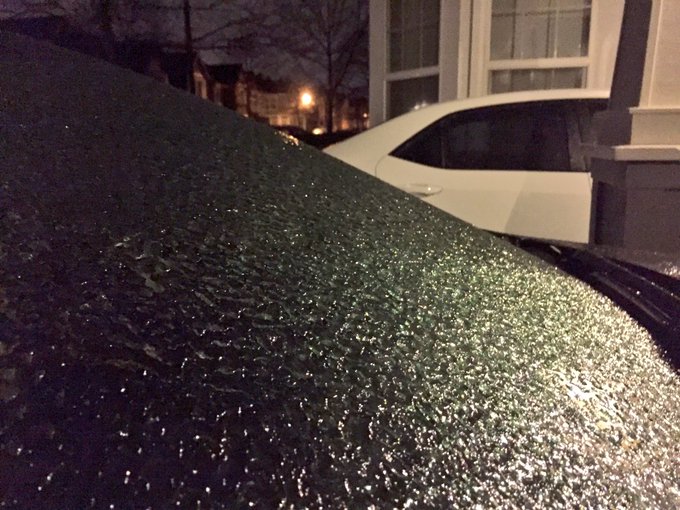
ICE!! Lots of it on cars, roads... everything. It's going to be a rough morning. USE CAUTION!

Temperatures hovering around freezing will keep conditions slippery on elevated and untreated surfaces, in particular, even though the freezing rain has ended for now, said AccuWeather Storm Warning Meteorologist Alex Avalos.
"Another round of freezing rain will likely overspread by early afternoon, keeping conditions slippery," Avalos said, adding that he didn't see temperatures rising above freezing until Friday evening.
 

100 million dead trees in California add fuel to wildfire debate

By Stephanie Koons, AccuWeather staff writer
February 3,2017, 9:42:44AM,EST
 
California has more than 100 million dead trees in its forests, and there is no consensus on their impact on the environment or how to deal with them.
In November, the U.S. Forest Service said an aerial survey revealed that 36 million additional trees had died in the midst of a multi-year drought, bringing the total since 2010 to more than 102 million.
The tree deaths have been concentrated in the southern and central Sierra Nevada, but experts warn of increasing deaths in forests all the way up to the Oregon border.
“The scope and magnitude of the problem is seemingly overwhelming,” said Janet Upton, a deputy director for the California Department of Forestry and Fire Protection (CAL FIRE).
The phenomenon raises questions on what causes wildfires as well as the role that wildfires play in the greater ecological scheme. Officials are also grappling with logistical, financial and public safety risks associated with the removal of the trees.
According to AccuWeather Senior Meteorologist Brett Anderson, five years of drought in California has been the primary cause of the tree deaths. While a series of potent storms in early 2017 has alleviated the dry conditions, it has not been enough to undo the damage to the trees or to prevent the die-off from continuing.
“When you have severe droughts, trees are going to die,” said Adrian Das, an ecologist with the U.S. Geological Survey.
Calif. dead trees
This June 6, 2016 photo shows patches of dead and dying trees near Shaver Lake, California. California's drought and a bark beetle epidemic have caused the largest die-off of Sierra Nevada forests in modern history. (AP Photo/Scott Smith)

The drought and the resulting tree deaths are byproducts of global climate change, Anderson and Das said.
“The fact that temperatures are warming means that the effects of the drought are probably exacerbated,” Das said.
If the tree population continues to thin out, Anderson said, California will face increased risks of erosion, mudslides and flooding due to the loss of natural barriers.
“These long-term droughts are more likely to be common over the next decade,” he added.
RELATED:
2016 declared hottest year on record for the globe
How does wildfire smoke impact your health?
Weekly wrap-up: Phil declares 6 more weeks of winter; California officials record highest Sierra snowpack in 22 years

According to some experts, the dead trees pose a major fire threat. When a lot of dead fuel remains on the ground, Upton said, fires burn hotter and damage the soil.
Not everyone agrees that dead trees increase the risk of wildfire. Dick Hutto, a professor emeritus of ecology at the University of Montana, said that large wildfires are almost always caused by dry weather.
“If you’re worried about fire, it’s the weather you’ve got to be worried about,” he said.
While people commonly think of wildfire as a destructive force, Hutto said, it actually serves a greater good in the ecosystem. Many plant species evolve in direct response to it; for example, morel mushrooms emerge and pine cones open after a wildfire.
In addition to drought, California's trees have been weakened by bark beetles.
“A lot of trees are dead from infestation,” said AccuWeather Senior Meterologist Ken Clark.
According to CAL FIRE, bark beetles attack stressed trees by boring holes into the bark. A healthy tree would be able to fend off attack by exuding pitch (a substance derived from the sap of coniferous trees) into the holes, pushing the beetle out. However, drought-stressed trees have a difficult time producing enough pitch to fight off insects.
“Over five years of drought has robbed trees of their normal ability to protect themselves from bark beetles,” Upton said. “There’s barely enough water to keep trees alive.”
While bark beetles have been destructive to trees, she conceded that there have only been a couple of fires in beetle-infested areas.
barkbeetle
Division Chief Jim McDougald of the California Department of Forestry and Fire Protection holds a piece of tree bark showing burrowing marks from a bark beetle infestation near Shaver Lake, California. (AP Photo/Scott Smith)

Although Hutto said he doesn’t support harvesting dead trees indiscriminately since it could disturb ecosystems, he and other experts agree that dead trees in populated areas pose major risks. That means removing trees that endanger people, homes, buildings and infrastructure, such as power lines.
While there is “zero chance of removing 100 million dead trees,” Upton said, California state officials are honing in on “10 high-hazard counties.” A Tree Mortality Task Force has been formed that includes over 80 local and state governmental organizations, including the California Department of Transportation.
The task force has so far removed about 423,000 trees, Upton said. In addition, the state government has provided about $15 million in funds to help communities deal with dead trees on a local level.


The state has also allocated about $6 million worth of equipment such as wood chippers, saw mills and air curtain burners (which mitigate smoke from open fire burning) to local governments to deal with dead trees.
California residents who face risks from wildfires and dead trees can learn about how to protect themselves and their property at CAL FIRE's website.

Weekly wrap-up: Phil declares 6 more weeks of winter; California officials record highest Sierra snowpack in 22 years

By Katy Galimberti, AccuWeather staff writer
February 3,2017, 9:17:21AM,EST
 
 Blinding snow squalls led to multiple accidents across Pennsylvania this week, leading to several fatalities.
In York County, a pileup involving 40 cars and 11 trucks occurred on Monday as an intense burst of snow hit along Interstate 83, killing one. A 20-car pileup led to at least one death in Jefferson County, Pennsylvania, on Monday along Interstate 80.
"As the squalls crossed major highways in the region, a sudden change in visibility and a quick covering of snow caused dangerous conditions," Senior Meteorologist Alex Sosnowski said.
Pennsylvania Snow Squalls Photo
Photo by J. Marc Harrison

In the long-standing tradition, Punxsutawney Phil issued his annual prognostication this week, calling for six more weeks of winter.
In California, officials measured the highest snowpack on the Sierra Nevada mountain range in 22 years this week.
As the snow melts in the spring, the runoff fulfills about 30 percent of California's water needs, the state's department of water resources said. Officials measured a snow water equivalence of 28.1 inches.
snowpack
Frank Gehrke, chief of the California Cooperative Snow Surveys Program for the Department of Water Resources, crosses a snow covered meadow after conducting the second manual snow survey of the season at at Phillips Station Thursday, Feb. 2, 2017, near Echo Summit, Calif. (AP Photo/Rich Pedroncelli)

A wet year so far has led to the significant snowpack and will likely ease drought concerns going into the next season.
Also this week, scientists said there was no "exceptional drought" area in the entire United States for the first time in nearly six years. Southern California was downgraded to an extreme drought. The U.S. Drought Monitor classifies exceptional drought as the most severe level.
drought_2_3_17
United States Drought Monitor (USDM) assessment for Jan. 24, 2017, released on Jan. 26, 2017. "L" and "S" indicate whether long-term or short-term drought impacts dominated. Areas designated "SL" are experiencing both scales of impact. (NOAA image/Climate.gov)

RELATED:
Rain may force closure of NRG Stadium roof on Super Bowl Sunday
Exploring the health benefits vs. hazards of humidifiers
Meteorologists, Punxsutawney Phil predict 6 more weeks of winter

Drought, high temperatures and winds continue to create dire wildfire conditions in Chile as the country faces one of its worst natural disaster in history.
Thousands have been displaced and more than 10 people have been killed due to the raging fires. More than 400,000 acres of forest have been destroyed over the last week, the Guardian reported.
Heat swelled over parts of Australia this week, leading to a high of 113 F (45 C) in Moomba in the central part of the country. A state-wide fire ban was declared in Victoria for the first time this summer.

Soaking rain, gusty winds to spread across UK into Friday night

By Eric Leister, AccuWeather meteorologist
February 3,2017, 2:17:43PM,EST
 
 A new storm blasting into the United Kingdom will continue to unleash soaking rain and strong winds into Friday night. More unsettled weather will follow this weekend.
"Rain will continue to spread from south to north across the U.K. into Friday night," AccuWeather Senior Meteorologist Kristina Pydynowski said, adding that the heaviest rain is targeting western areas.
Rainfall is not expected to be heavy enough to produce widespread flooding problems. However, localized amounts up to 25 mm (1 inch) could result in slower travel.
"Soaking rain will focus on Belfast on Friday night," Pydynowski said. "Drivers will face reduced visibility and a heightened risk of hydroplaning due to standing water."
friday_night

As rain spreads northward across the southern U.K., winds will become stronger into Friday evening with the greatest impacts across southern Wales and southern England.
"There will be a brief period of winds gusting between 40 and as high as 50 mph (65 to 80 km/h) across the south of England and Wales," AccuWeather Meteorologist Rob Richards said. "This includes London and Cardiff."
Such winds can cause sporadic tree damage, power cuts and minor travel delays.
Stronger winds will put the southern coast of England at greater risk for power cuts and disruptions to air and rail travel. Coastal flooding may also occur at high tide.
RELATED:
United Kingdom Weather Center
MinuteCast® for your location
Interactive United Kingdom weather radar

"The coastline will face more prolonged wind gusts of 50-60 mph (80-95 km/h) with isolated higher gusts," Richards said.
Winds gusted to 64 mph (103 km/h) at Berry Head on Friday afternoon.
Gusts will generally be on the order of 30-40 mph (48-65 km/h) as the storm continues to track northward over Scotland on Saturday. Rainy spells, which will be wintry over the hills, will accompany the storm to start the weekend.
Odd showers will follow over many of the same areas on Sunday.
As quick as this storm departs, two more will race eastward from the Atlantic into France this weekend.
Weekend UK Feb 3 PM

"The storms this weekend are expected to track into France far enough to the south that the southern U.K. should escape strong and damaging winds," Pydynowski said. "Rain should still spread across southern England at times, meaning those in London will want to grab a brolly before heading out for weekend plans."
How far north each storm tracks will determine the northern extent of the rain.
"The good news for those with outdoor plans in Wales, away from the western coast, and the West Midlands is that the odd showers this weekend will be confined to Saturday night when most people will be sleeping," Pydynowski said.
Temperatures will otherwise trend back to more seasonable levels for this weekend across the U.K.
Early next week, the storm track should press back to the north and a cold front will sweep through the U.K. with a spell of rain and wind.
"This front will bring the risk of locally damaging winds with gusts exceeding 50 mph (80 km/h) to the western and northern U.K.," Pydynowski said.
 

Springlike warmth to challenge records across eastern US next week

By Renee Duff, AccuWeather meteorologist
February 3,2017, 12:26:05PM,EST
 It will feel more like spring across part of the eastern United States next week as temperatures briefly soar to record-challenging levels.
Residents from Atlanta to Nashville to Washington, D.C., will trade in winter coats for t-shirts by midweek.
A major storm will take shape over the center of the country by Tuesday. Unseasonable warmth will then build on the southeastern side of the storm.
“Even though Punxsutawney Phil called for six more weeks of winter, to many in the Southeast it will feel more like mid-April than early February for a brief period next week,” AccuWeather Meteorologist Faith Eherts said.
Mild Tue-Wed Southeast

Tuesday is shaping up to be the warmest day of the stretch, when records that have held since the 1900s could be in jeopardy throughout the Southeast.
“Throughout Maryland and Virginia, high temperatures on Tuesday will reach upwards of 15 degrees above average,” Eherts said. “Farther south, they may exceed 20 degrees above average.”
Widespread highs in the middle to upper 70s F are in store across the Deep South, with 60s and lower 70s in store for much of the Ohio Valley and southern mid-Atlantic.
“Temperatures will soar into the 60s as far north as Washington, D.C,” Eherts said.
RELATED:
Millions to face storm impacts next week: Snow, rain, wind and severe weather to unfold
Exploring the health benefits vs. hazards of humidifiers
Climate change isn't the only culprit behind massive ice shelf crack in Antarctica

A few of the cities that will challenge record warmth include New Orleans; Montgomery, Alabama; Atlanta; Jacksonville and Pensacola, Florida; Charlotte and Raleigh, North Carolina; Nashville; and Washington, D.C.
The bulk of the warmth will fail to reach much of the interior Northeast and New England, where periods of snow and ice can occur early next week.
Most of Tuesday will be dry and sunny across the southern Atlantic Seaboard, which is great news for those who hope to enjoy the brief spurt of warmth by hiking, biking or walking.
Behind the passage of rain and thunderstorms late Tuesday and Wednesday, warmth will be whisked away and temperatures will fall back to within a few degrees of average across the Southeast.
Northeast cold returns next week

The brunt of the chill will sweep across the Midwest and Northeast late next week as temperatures plummet to unseasonably low levels.
Temperatures may rebound once again across the Southeast and perhaps the mid-Atlantic as quickly as next weekend.