By Faith Eherts, AccuWeather meteorologist
May 13,2017, 9:07:05AM,EDT
A storm spinning in the Pacific Ocean just off the coast of Chile will continue to batter the country with rain, wind and high-elevation snow through Friday.
Wet weather in place over the center of the country this week intensified on Thursday, heightening the threat of rain-related issues into the weekend.
“Rain will fall from region 3 to region 8 through Friday night, but the heaviest rains will be regions 3, 4 and 5,” said AccuWeather Senior Meteorologist Jason Nicholls.
Several major cities will be at risk for heavy rainfall and consequent flooding, including La Serena and Santiago.
“The capital of Santiago will have 25-50 mm (1-2 inches) of rain,” said Nicholls.

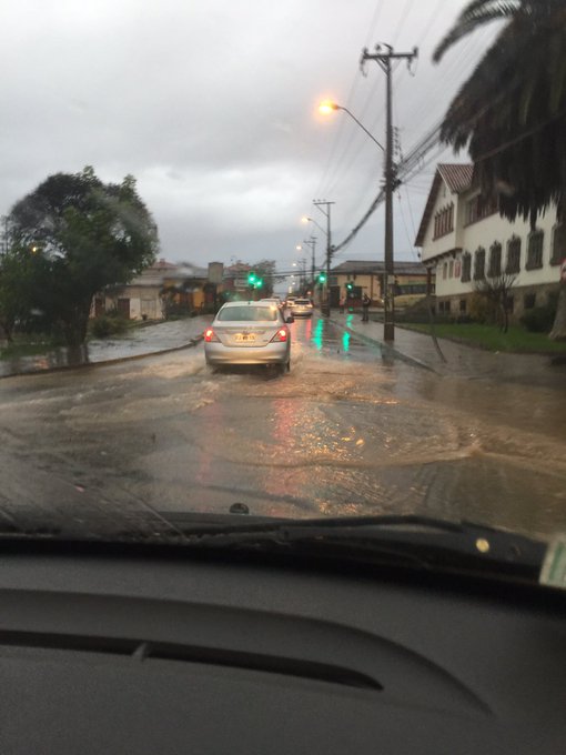
Urban flooding is likely in the cities, especially around low-lying and poor drainage areas.
Since heavy rain is uncommon in these regions during this time of year, impacts will be magnified.
On average, there is only a 3 percent chance of precipitation in La Serena on any given day in mid-May. Even then, the likelihood of receiving over 10 mm of rain is extremely slim.
However, parts of the city recorded over 120 mm (4.7 inches) of precipitation from this storm as of Friday morning.
Even areas that get little rainfall, such as Capiapo, should anticipate some flooding. Area creeks and rivers can undergo rapidly rising water levels due to rainfall in nearby higher elevations.
Residents should avoid driving or walking through flooded areas, as waters can move swiftly or could be contaminated.
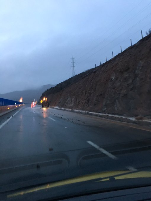
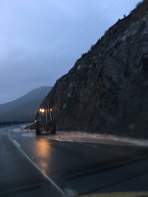
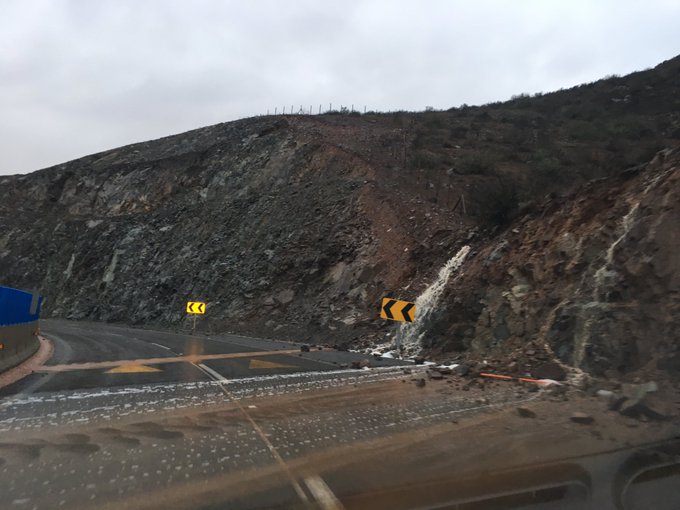
In more remote areas, the persistent rainfall could result in mudslides or landslides as well.
“Coquimbo region (region 4), including La Serena, continues to look like the bull's-eye for the heaviest rain,” said Nicholls.
“This area will have 50-100 mm (2-4 inches) of rain with locally up to 150 mm (6 inches).”
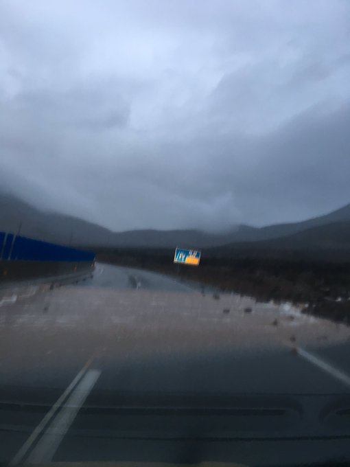
PRECAUCIÓN ruta 5, cuesta Bs Aires, rodados, escurrimientos y máquinas en vía al norte #LaSerena @biobio @Cooperativa @Emol @tteinforma_IV
Combined, the threat of flooding and mudslides could make many roads impassible.
The Meteorological Office of Chile also warns that strong winds could accompany this storm.
After impacting regions 3-6 and Santiago on Thursday, the winds are expected to be strongest across region 2 on Friday.
The combination of heavy rain and strong winds have left approximately 29,000 people without electricity, according to tvi24.
The site also reports that around 7,000 people are without drinking water as a result of the destructive weather, and washed-out roads have isolated almost 2,000 residents.
RELATED:
Chile Weather Center
Adrian weakens to a depression after becoming earliest tropical storm on record in east Pacific
Detailed forecast for Santiago, Chile
Over the higher elevations to the east, conditions will be right for plenty of mountain snow as well.
“Snow will fall in the central and northern Andes above 2,500 meters with snowfall of up to a meter or two by Saturday morning,” said Nicholls.
The snow will lower visibility and make roads treacherous through the mountains, making travel hazardous and potentially impossible for a time.
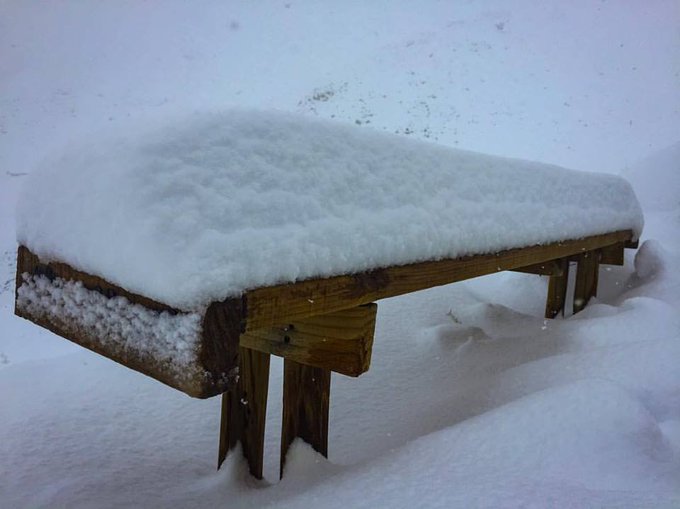
The snow is stacking up in Chile. Ski Arpa Snow Cats are reporting 15 plus inches and still snowing.
However, many ski resorts will welcome the early season winter weather, including El Colorado, La Parva and Valle Nevado, which are all above 2,500 meters and preparing to open for the season in early June.
While these regions can anticipate a period of dry weather to follow the rain, the threat of heavy rain will shift southward into regions 9-12 and 14 for the weekend.



No comments:
Post a Comment