Winter Storm Iras will deliver snow and some ice to the Midwest and interior Northeast to begin the week as snow winds down in the northern and central Rockies.
(MORE: How Winter Storms Are Named | Winter Storm Central)
During the weekend, Iras brought significant snow and ice to parts of the Pacific Northwest. Up to an inch of ice was reported in Lane County, Oregon, which includes Eugene, Creswell and Goshen. Eugene, Oregon, also picked up 4.5 inches of snow. Freezing rain and snow impacted the Salt Lake City metro and Portland area Sunday.
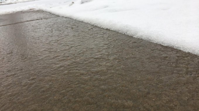
Cold air trapped in the valleys of western Colorado also resulted in freezing rain there on Monday. Around the Grand Junction area, near one quarter of an inch of ice had accumulated as of late Monday morning, leading to ice-covered roads and sending cars into ditches.
(LATEST NEWS: Winter Storm Iras Impacts)
#Ice
Storm Warnings continue this morning. THIS is what roads/walks look
like when it rains at 25 degrees..EXTREMELY DANGEROUS TRAVEL! #COwx

Current Conditions and Radar

Winter Weather Alerts
Monday Night's Forecast
- Snow winds down in the northern and central Rockies in association with Iras. Freezing rain is possible in valleys where cold air is trapped in western Colorado.
- Areas from the northern Plains into the upper Midwest and Great Lakes will see snow pivot through.
- Some sleet/ice is possible on the southern edge of that Plains/Midwest precipitation area. This includes South Dakota, southern Minnesota, northern Iowa, northern Illinois and southern Wisconsin.

Monday Night's Forecast
Tuesday's Forecast
- Low pressure wraps up in the Great Lakes with snow and wind in the northern Great Lakes and upper Midwest, including Minnesota, northern Wisconsin and northern Michigan.
- A wintry mix of sleet, ice or snow pushes into the interior Northeast and eastern Great Lakes. Most areas will start as snow before changing to a wintry mix.

Tuesday's Forecast
How Much Snow?
- Less than 6 inches of snow are expected for most areas from eastern Montana to the Dakotas, Minnesota, northern Wisconsin and northern Michigan.
- Most areas of the interior Northeast from northern New England to upstate New York and northwest Pennsylvania will also see less than 6 inches of snow.
- Light ice accumulations are expected across interior parts of the Northeast, leading to slippery travel.

Snowfall Forecast
Snowfall Totals So Far
Here are some select snow totals from Iras, as of Monday evening.California: 25 inches in Mammoth Lakes
Colorado: Estimated 18.2 inches in the higher terrain near Steamboat Springs
Idaho: 44 inches at the Atlanta Summit Snotel; 2-4 inches in Boise
Montana: 30.3 inches near Island Park at the Black Bear Snotel
Nevada: 5.0 inces near Incline Village
Oregon: 20 inches near Paulina; 9.0 inches in Bend; 4.5 inches in Eugene
Utah: 16.6 inches near Almo at the George Creek Snotel
Washington: 14.0 inches in Cle Elum
Wyoming: Estimated 48 inches near Driggs at the Grassy Lake Snotel
Ice Accretion Totals So Far
Here are some select ice totals from Iras, as of Monday evening.California: 0.25-0.50 inches in Big Pine
Colorado: 0.25 inches near Grand Junction
Idaho: 0.50 inches in Fruitland
Nevada: 0.10 inches near Gardnerville Ranch
Oregon: 0.75-1 inch of ice in Creswell; 0.75 inches near Eugene
Washington: 0.50 inches near Vancouver


No comments:
Post a Comment