Published: October 16,2016
Typhoon Sarika is now in the South China Sea and will pose a threat of damaging winds and flooding in parts of southern China and Vietnam early this week. The typhoon has already pounded the northern Philippines where it made landfall early Sunday morning.
(MORE: Hurricane Central)
Sarika — given the name "Karen" by the Phillipine Atmospheric, Geophysical and Astronomical Services Administration (PAGASA) — moved ashore about 85 miles northeast of Manila near the town of Baler as the equivalent of a Category 4 storm with 130 mph maximum winds.
(NEWS: Sarika/Karen Turns Deadly in the Philippines)
Current Storm Information, Infrared Satellite Image
(FORECAST: Manila)
Forecast Rainfall: Sarika/Karen
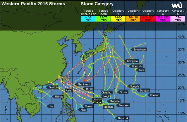
The typically #typhoon-hit northern #Philippines have seen only 1 typhoon this year. #Sarika / #KarenPH will change that.
(INTERACTIVE: Wundermap Forecast Path)
This will steer Sarika toward China's Hainan Island Tuesday, then northern Vietnam as a weakened system Wednesday.
Damaging winds are possible along the path of Sarika. In addition, heavy rain will contribute to possible flooding and landslides.
(MORE: Countries Most Hit By Tropical Cyclones)
Forecast Path: Sarika/Karen
Check back with us at weather.com for the latest on this typhoon threat.


No comments:
Post a Comment