Published: June 10,2016
It's June, and parts of the U.S. are bracing for record heat – but there are a few locations where a winter chill is in the air and snow is flying.
Winter storm warnings were posted for northeast Alaska's Brooks Range, where the National Weather Service anticipated 4 to 9 inches of total snow through Friday.
 Snow
Snow ? The calendar may say that it is June; however, snow is expected today on the North Slope
  . #akwx
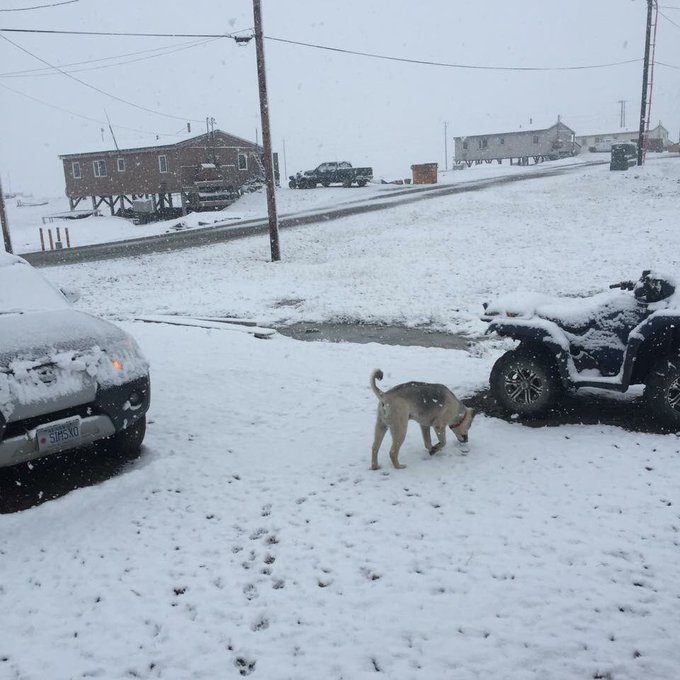
 Wednesday and Thursday, snow fell along the Arctic coast, including the cities of Barrow and Katovik.
It's snowing in June in my Mom's village of Kaktovik. Very unusual weather. Photo by Tori Sims.
It was also the sixth highest June daily snowfall on record, there, according to the National Weather Service.
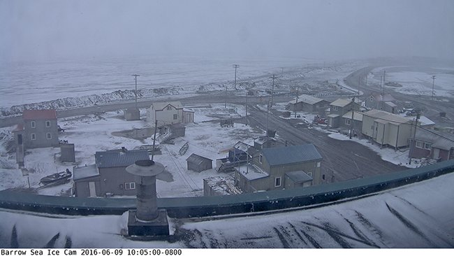
Yep, that's #snow on the ground in Barrow, #Alaska now, per UAF Sea Ice Cam. They average 0.7" snow each June.
Most locations average about an inch of snow for the month. This year, however, it's somewhat of a surprise, considering how mild conditions have been.
Alaska weather blogger Dr. Richard James noted wet snow was even observed Thursday in the village of Umiat, about 165 miles southeast of Barrow.
James blogged that this is rather unusual in Umiat in June, with measurable snow only occurring in five other Junes of record since 1946.
 Upper-Level Trough Over Northern Alaska Producing Wintry Conditions
This
snow was brought about by a trough (dip in the jet stream) over
northern Alaska, allowing cold temperatures to prevail. Within the
trough, an area of low pressure formed just north of the state. The low
and attendant cold front was responsible for lifting moist air at the
surface, which produced clouds and snow. Upper-Level Trough Over Northern Alaska Producing Wintry Conditions
With a building ridge over western and central Canada, the low was blocked from moving very much.
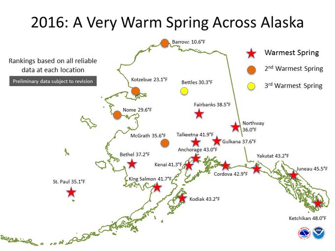
NOAA's National Centers for Environmental Information just announced that Alaska had their warmest spring (March-April-May) on record.
With all of the warm temperatures across Alaska over the past few months, it didn't seem like wintry conditions would ever return, at least not in June. On the Arctic coast, Barrow has recorded above average temperatures for every month in 2016, and just chalked up a daily record high Monday, reaching 51 degrees.
(MORE: Spring 2016 Was Warm and Wet in the United States: Alaska Shatters Spring Record)
From #NCEI, #Alaska had the warmest spring of record this year, smashing the previous warmest set in 1998.#akwx
Down In The Lower 48
If you would like to find wintry conditions this late in the season down in the Lower 48 states, look no further than at Mount Washington, New Hampshire.The Mount Washington Observatory, where winds howl and snow falls most months of the year, sits at an elevation of 6,288 feet.
It has been quite wintry over the past couple of days, thanks to the aforementioned sharp southward dip in the jet stream.
Wednesday and Thursdsay, a total of 1.8 inches of snow was measured at the observatory, accompanied by average wind speeds from 55-66 mph, according to observatory records.
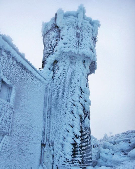
Another icy start to the day. Good news-warmer wx for Saturday. #nhwx #nh #newhampshire #n… http://ift.tt/1tg7XUt
Glaze/rime ice grows into the wind. This is the ice on our @MWObs instrument tower this a.m. #nhwx #winterisntover
The average high temperature in June is around 50 degrees with a typical low in the upper 30s. June temperatures have tumbled as low as 8 degrees in 1945, and have rocketed as high as 72 degrees in 2003.
Typical sustained winds atop Mt. Washington in June are about 27-28 mph. A wind gust to 136 mph was once measured at the summit in June 1941.
You have to be a hearty soul, like the weather observers there, to endure these harsh conditions.
MORE: Mt. Washington Photos


No comments:
Post a Comment