By Mark Leberfinger, AccuWeather.com Staff Writer
February 15,2016; 10:02PM,EST
A snow and ice storm will spread from Tennessee to Maine and will continue to create dangerous travel conditions on Presidents Day.
Snow and ice will accumulate in Washington, D.C., Philadelphia and New York City before changing over to rain, AccuWeather Senior Meteorologist Krissy Pydynowski said.
"Several inches of snow will make for slow and slippery travel and disruptions from the Appalachians to portions of western and northern New York," she said.
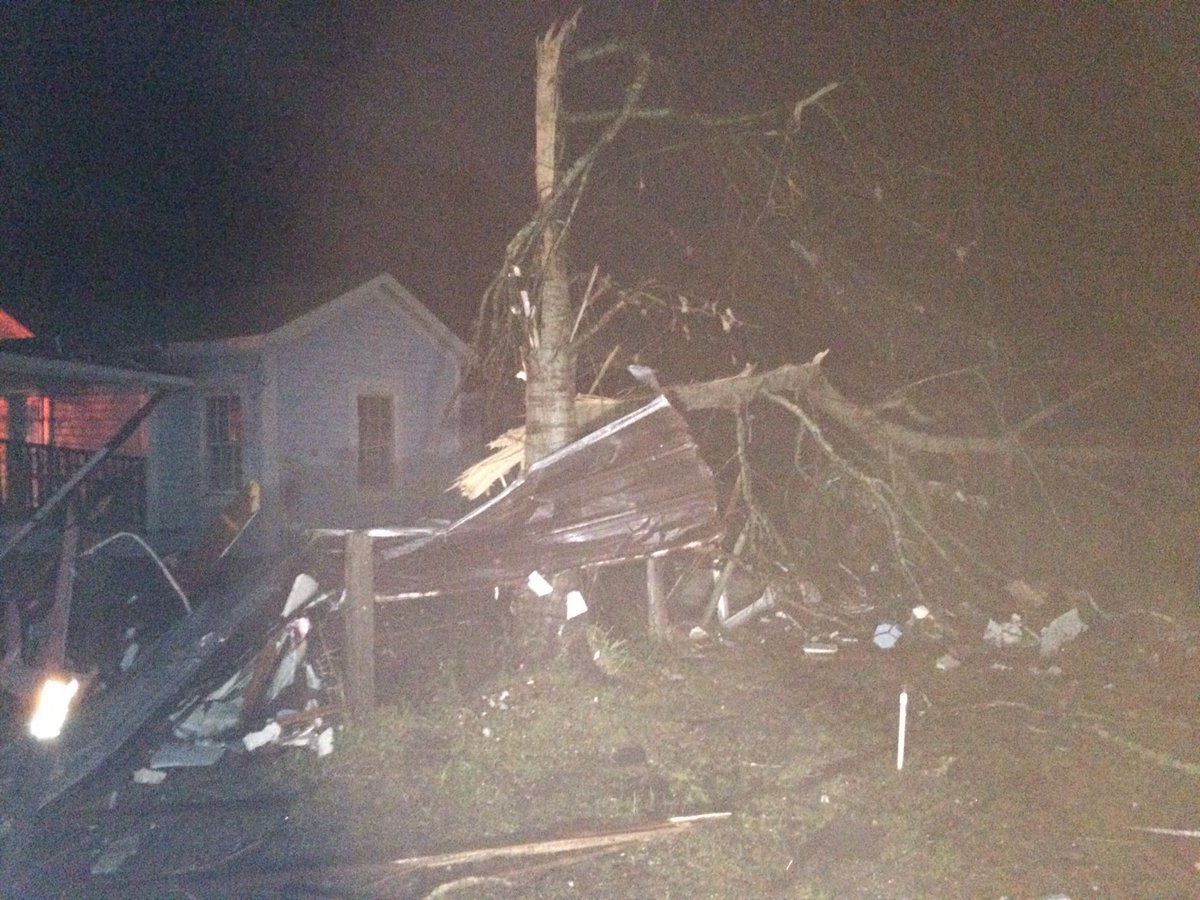
The same storm system is also producing severe weather in the Deep South and has spawned several tornadoes in Mississippi and Alabama.
RELATED:
Presidents Day snow and ice storm to administer wintry travel in much of eastern US
AccuWeather winter weather center
Northeast weather radar
UPDATES: (All times are listed in EST)
11:02 p.m. EST Monday: Icy travel on I-70 east of Frederick, Maryland, according to Maryland Department of Transportation.
10:46 p.m. EST Monday: More than 10,000 flights have been either canceled or delayed Monday in the United States, FlightStats reports.
10:44 p.m. EST Monday: Vehicle crash blocks part of the Cross County Parkway westbound at Yonkers, 511NY reports.
10:33 p.m. EST Monday: Storm-related delays on SEPTA lines in Philadelphia area.
10:16 p.m. EST Monday: Sleet is falling in Chelsea, Massachusetts, an NWS-trained spotter reports.
10:07 p.m. EST Monday: 0.20 inches of ice fell in Farmington, North Carolina, while 0.10 inches of ice fell 2 miles west-southwest of Fletcher, North Carolina, according to CoCoRaHs.
9:58 p.m. EST Monday: Interstate 70 in Frederick County, Maryland, has reopened, state officials said.
9:46 p.m. EST Monday: Baltimore County, Maryland, offices are opening late on Tuesday.
9:38 p.m. EST Monday: More than 5,100 Pennsylvania customers, mostly in eastern Pennsylvania, are without power, utilities report.
9:24 p.m. EST Monday: The speed limit on the Massachusetts Turnpike has been reduced to 40 mph from the New York state line to exit 15 in the town of Weston, according the Massachusetts State Police.
9:11 p.m. EST Monday: Conditions have changed to sleet around the Scranton and Wilkes-Barre, Pennsylvania area:
8:13 p.m. EST Monday: Rhode Island emergency management officials are urging caution on the roadways:
7:31 p.m. EST Monday: Over 19,000 Gulf Power customers in the Florida Panhandle are without power, the utility reports.
7:23 p.m. EST Monday: Roads are becoming snow covered in parts of south-central and northeastern Pennsylvania according to 511PA:
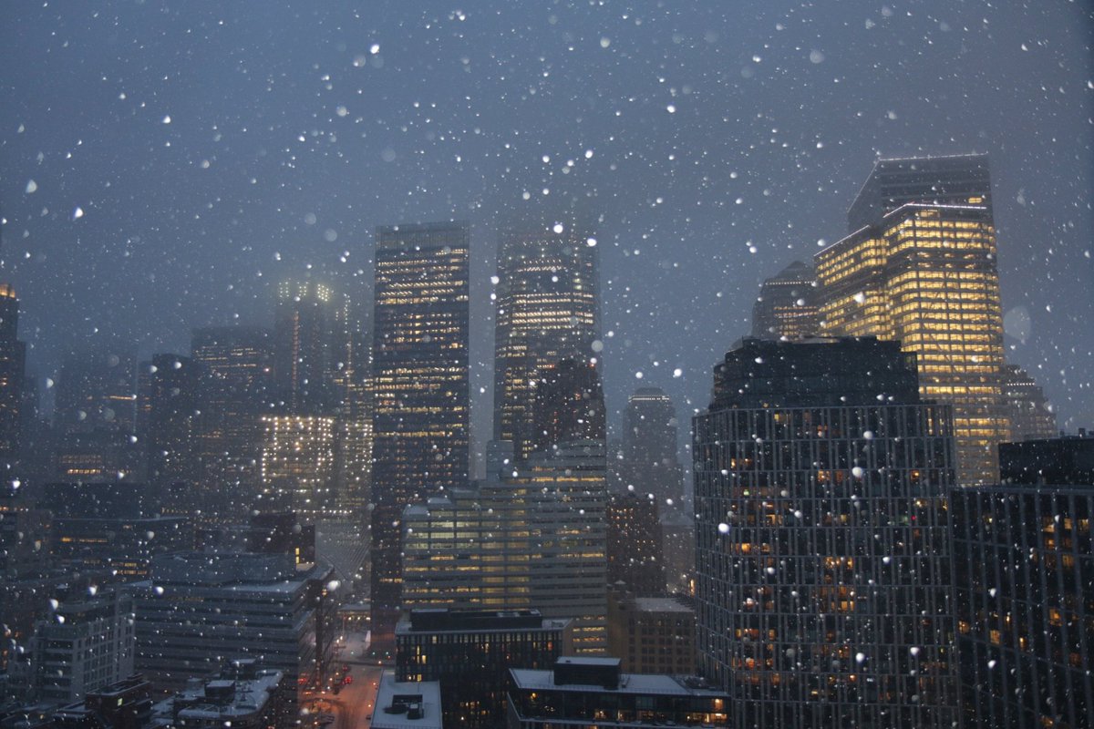
7:15 p.m. EST Monday: A look at the snow that fell earlier tonight in New York City:
One World Trade lost in the #PresidentsDay snowstorm @EverythingNYC
6:30 p.m. EST Monday: Over 500 crashes have been reported in Virginia today:
5:12 p.m. EST Monday: Ice accumulation due to freezing rain is evident in Waxhaw, North Carolina.
4:59 p.m. EST Monday: A possible tornado caused the roof to blow off of this structure in Sylvarena, Mississippi.
4:30 p.m. EST Monday: A lightning strike caused a tree to break into pieces near Lake Tuscaloosa in Alabama.
4:12 p.m. EST Monday: A glaze of ice has developed on cars and untreated surfaces in Greer, South Carolina.
4:01 p.m. EST Monday: Snow and ice-covered roads reported in Long Island, 511NY reports:
3:50 p.m. EST Monday: More tornado damage is being reported across Mississippi.
3:11 p.m. EST Monday: Damage from a tornado that touched down in Alexandria, Louisiana earlier today.
2:40 p.m. EST Monday: Storm damage reported at Wesson Attendance Center in Wesson, Mississippi.
For archived reports of the storm, click here.


No comments:
Post a Comment