The first severe weather watch of 2016 was issued Friday afternoon for parts of Texas and Louisiana, and the threat for severe thunderstorms will shift east through the weekend.
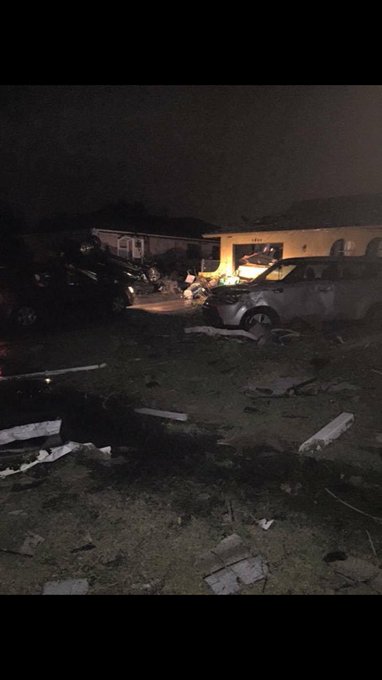
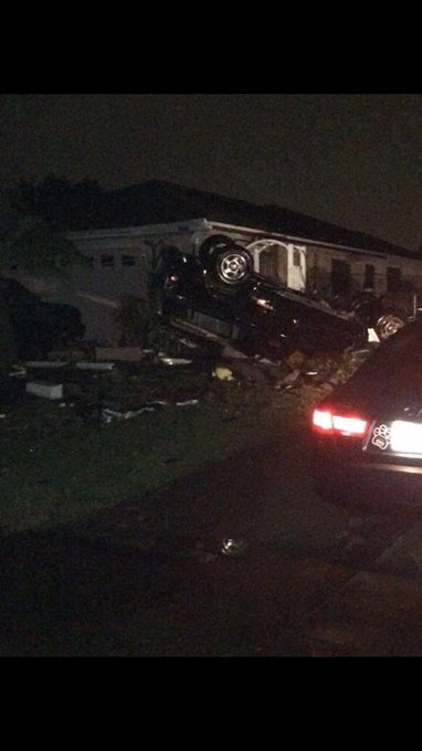
Saturday evening, damage from a probable tornado was reported in the vicinity of Cape Coral, Florida. There were reports of minor structural damage, flipped cars, uprooted trees and downed power lines.
Additional rainfall from this weekend's thunderstorms will fall on parts of the Lower Mississippi Valley, where significant river flooding will persist into the weekend. This comes on the heels of what was the wettest month of December on record over parts of the region.
(MORE: Major Flooding in the Mississippi River Valley)
Severe Weather Forecast
Thunderstorm Forecast
- Thunderstorms and locally heavy rain are possible from the Tennessee Valley into the Southeast, including Florida and the Carolinas.
- There is a threat of severe thunderstorms over the central to southern Florida peninsula.
- A few strong to severe thunderstorms may develop overnight across the eastern Carolinas.
- Some heavy rain will be possible from the Middle Atlantic states into the Northeast as low pressure races northeastward.
- Scattered thunderstorms will impact eastern North Carolina in the morning.
- Low-topped thunderstorms may develop from New Jersey and Long Island into New England, posing a threat of locally damaging winds.
Current Radar with Watches and Warnings
Storm Reports: Hail in Texas, Possible Tornado in Florida
Numerous severe thunderstorms produced large hail in southeastern Texas late Friday afternoon and into Friday night. The storm included hail almost the size of tennis balls just southeast of Huntsville and in the greater Houston area just north of Bellaire. Hail to the size golf balls was also reported at Point Blank.A few of the hailstorms reached southwestern and central Louisiana with hail up to the size of ping pong balls late Friday evening. Strong thunderstorm winds downed a few trees in Bossier and Bienville parishes of northern Louisiana.
On Saturday evening, a possible tornado was reported in Lee County, Florida, near Cape Coral. The National Weather Service reported multiple trees and power lines down following the storm as well as structural damage to several houses. A social media report added that a vehicle had been overturned near the possible tornado.
These pictures were taken by Edward Rhoads of tornado damage from Cape Coral, Florida.
Snapped An Awesome Shot? Share Your Photo!
If you crave pictures of severe weather, you've found your home here. Upload your photos or video (taking care to only take photos and videos from a safe location) to us and share your experience!(PHOTO/VIDEO GALLERIES: Severe | Storms)


No comments:
Post a Comment