By Eric Leister, Meteorologist
October 19,2015; 10:30PM,EDT
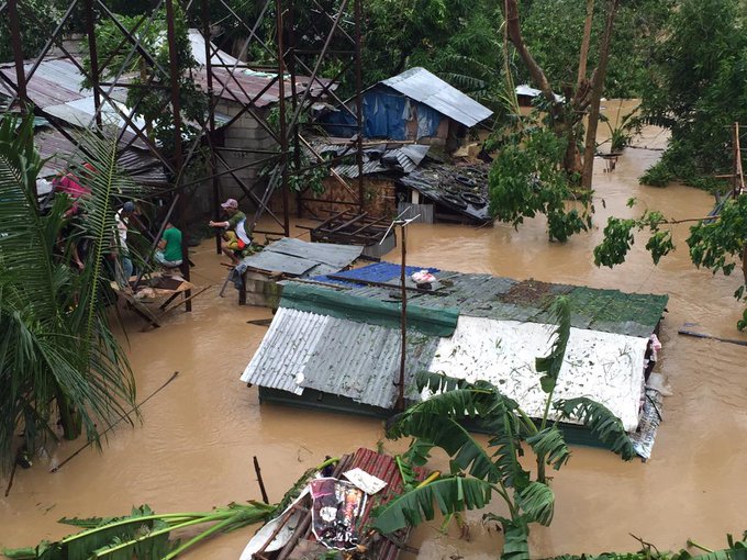
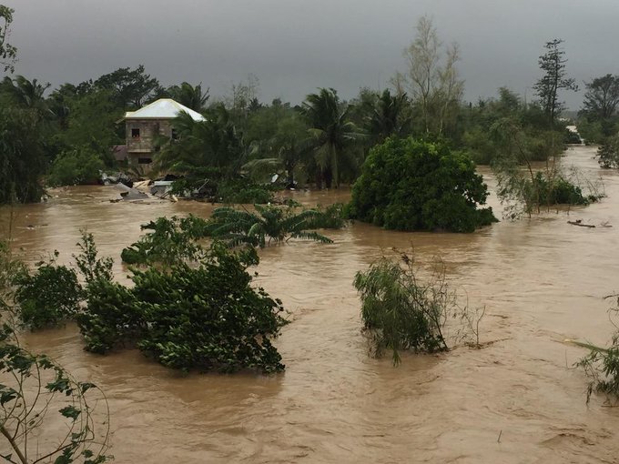
Tropical Storm Koppu, also known as Lando, has killed at least 11 people in the Philippines according to the Associated Press. Even in a weakened state, Koppu will continue to bring life threatening conditions to the northern Philippines through at least Wednesday.
Koppu developed into a typhoon early Friday morning local time and strengthened through the end of the week, reaching super typhoon status late Saturday evening. With wind gusts up to 241 km/h (150 mph), The cyclone's intensity was similar to that of a strong Category 4 hurricane in the Atlantic Ocean.
Very early Sunday morning, Koppu made landfall near Casiguran, Aurora on the eastern coastline of Luzon with the intensity of a Category 4 hurricane.
Koppu slowly tracked westward across northern Luzon through the weekend before turning north along the west coast of Luzon on Monday. The combination of a powerful and slow-moving typhoon resulted in disastrous situation for residents and communities in its path across northern Luzon. Life-threatening conditions will persist across northern Luzon through the middle of the week as Koppu drifts northward.
In Baguio, over 900 mm (36 inches) of rain had already fell by Tuesday morning, local time. The city could receive 75-150 mm (3-6 inches) or more of additional rain before Koppu pulls away.
"A total of 300 to 600 mm (12 to 24 inches) of rain is expected to be widespread," AccuWeather Meteorologist Adam Douty said. There will even be localized amounts upwards or in excess of 900 mm (36 inches). Such rain is sure to trigger severe and life-threatening flooding and mudslides.
"The most significant rain will fall in the mountainous terrain of northern Luzon," Douty added.
Baguio, Sagada, Candon, Vigan City and Laoag City are among areas that will continue to see heavy rain through at least Tuesday.
RELATED:
Philippines Weather Center
Accuweather West Pacific Typhoon Center
Taiwan Weather Center
Streams and rivers will quickly turn into raging waterways and flood neighboring homes and land, roads and bridges can get cut off and low-lying communities could get turned into lakes.
Impacts from Koppu will not be limited to the Philippines. Taiwan, Japan and far eastern China remain on alert for potential hazards later this week.
"By Wednesday, we should see Koppu slowly begin to pull to the north and impacts in Taiwan should gradually increase," stated Douty.
While there remains some uncertainty in the track as Koppu drifts to the north during the second half of the week, there is growing confidence that locally heavy rain will fall in Taiwan.
AccuWeather meteorologists think the greatest threat for flooding across Taiwan will occur in the eastern part of the island. However, depending on the exact track of Koppu, there could still be locally heavy rain and gusty wind in western parts of the country as well.
Behind Koppu is Typhoon Champi, currently the equivalent of a Category 3 hurricane. Champi has weakened since strengthening to a Super Typhoon Sunday night local time.
While Saipan was battered by Champi, Guam, was far enough south to miss the worst of the cyclone. Even so, wind gusts of 65-80 km/h (40-50 mph) were common along with downpours.
The latest indications point toward this system curving to the north, then northeast well away from Japan. However, Iwo Jima will be in the path of this typhoon around the middle of the week. If Champi maintains its strength, damaging wind and flooding rain will slam the small island.
Content contributed by AccuWeather's Senior Meteorologist Kristina Pydynowski and Meteorologist Courtney Spamer


No comments:
Post a Comment