By Katy Galimberti, AccuWeather.com Staff Writer
March 23,2015; 9:00PM,EDT
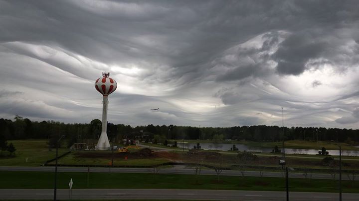
Formed with an appearance that simulates rolling and crashing waves, the clouds filled area skies around noon EDT Sunday, March 22.
"Asperatus clouds form on the outside of precipitation areas, where the rain attempts to invade dry air," AccuWeather.com Meteorologist Jesse Ferrell said.
The unique cloud formation can also appear deceptively ominous as the accompanying darkness and bulky shape do not always indicate a storm.
"The clouds seemed to have formed on the leading edge of some rain approaching from the west and south," AccuWeather.com Meteorologist Alex Sosnowski said. "Light rain was developing in the area between 11 a.m. and noon."
RELATED:
Road Trip Survival: Recognizing Which Clouds Mean Danger
PHOTOS: 'Bizarre Beautiful' Clouds Hover Over Atlanta, Resemble a Roller Coaster
TIMELAPSE: Rare Hole Punch Clouds Drift Over Spokane, Wash., at Sunset
Best #Undulatus #Asperatus (wave) clouds pic from Sunday here in Pooler. Taken by Amanda Lynn near @SAVHHIairport.


No comments:
Post a Comment