By Kevin Byrne, AccuWeather.com Staff Writer
March 1,2015; 10:54PM,EST
Snow and ice are kicking off March across the Northeast and mid-Atlantic as yet another winter storm moves into the area because of freezing rain.
Snow, sleet and freezing rain tracked from the southern Plains to the Ohio Valley on Saturday night, covering roads with upwards of 6 to 8 inches of snow.
Similar conditions can be expected across the Northeast on Sunday along the I-80, I-81, I-90, and I-95 corridors with western Pennsylvania picking up the highest snow accumulations.
"The heaviest snow for Boston will come Sunday night and the city's seasonal snowfall record of 107.6 inches from 1995-96 will be challenged," said AccuWeather.com Meteorologist Kristina Pydynowski.
RELATED:
Northeast Interactive Radar
AccuWeather Winter Weather Center
March to Start with Disruptive Snow, Ice in Northeast
UPDATES: (All times are listed in EST)
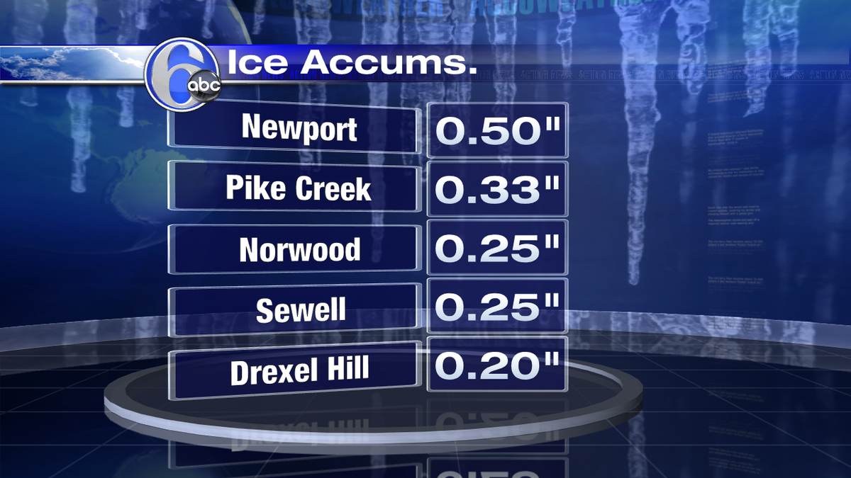
10:54 p.m. EST Sunday: Up to a half inch of ice fell in parts of New Jersey.
Yikes! A 1/2 an inch of ice in Cumberland County! Even though precip is moving out, use extreme caution if you're out
10:20 p.m. EST Sunday: About 7,000 New Jersey electric customers are without service at this hour, utilities report.
9:22 p.m. EST Sunday: More than 6,500 customers in Maryland without power, the Maryland Emergency Management Agency reports.
9:05 p.m. EST Sunday:
[9pm] Updated Observed Snowfall. Highest state totals: Bridgeport #CT 5", Westerly #RI 4.5" & Fairhaven #MA 4" http://ow.ly/JNB75 #SNEwx
Maine Turnpike @MaineTurnpike Follow
Speed limit reduced from the NH state line to Exit 53, West Falmouth http://www.maineturnpike.com/Traveler-Services/Alert.aspx?alertid=1023 …
MDTA @TheMDTA Follow
Update: Crash I-95 northbound just prior to MD 24 has cleared. All lanes have re-opened. #mdtraffic
7:05 p.m. EST Sunday:
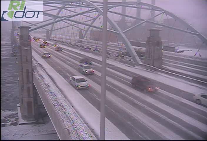
Snowfall is picking up throughout Rhode Island. Drive slowly and give yourself plenty of time if you have to travel.
Mass State Police ✔ @MassStatePolice Follow
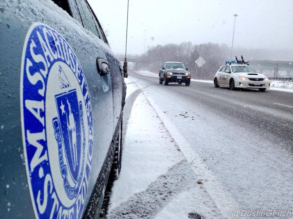
#MAtraffic Speed limit on the Mass Pike reduced to 40 mph from the NY border to Exit 11.
#MAsnow is falling in most of the state.
Take ur time on the roads. It's most slick when there is just a coating!
4:49 p.m. EST Sunday:
NWS Indianapolis ✔ @NWSIndianapolis Follow
Ed Vallee @EdValleeWx Follow
GOOD news: Temps rising slowly in S NJ
and around PHL. Up to 29 at PHL and in the low 30s in S NJ. Expect icing
to ease by late evening.
4:13 p.m. EST Sunday:
NB I-895 is SHUT DOWN at ex14 Moravia Rd due to a motor vehicle collision #BalTraffic @TheMDTA @mdfop34 @BmoreCityDOT
3:17 p.m. EST Sunday:
NWS Pittsburgh ✔ @NWSPittsburgh Follow
It's slushy out there with temps rising
this afternoon...but could be a nuisance later in some places as temps
drop into 20s overnight.
2:34 p.m. EST Sunday: Snow and ice-covered roads around New York City and Long Island. Motorists should proceed with caution and avoid unnecessary travel.
2:05 p.m. EST Sunday: Heavy snow has dropped visibility down to a quarter-mile in New York City.
1:55 p.m. EST Sunday:
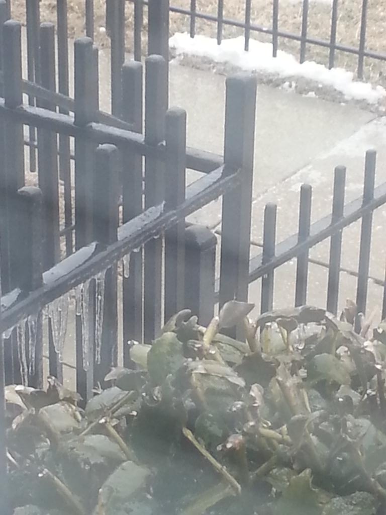
DC is an ice rink.
12:39 p.m. EST Sunday:
12:05 p.m. EST Sunday: According to AccuWeather.com Meteorologist Kristina Pydynowski, "Ice continues along the 1-95 corridor in Virginia. Even where temperatures inch above freezing and rain mixes in, motorists should still use caution as road temperatures will lag behind and keep travel slick."
11:50 a.m. EST Sunday: Power outages reported around Richmond metropolitan area and surrounding cities due to persistent freezing rain since about 9:30 a.m.
11:05 a.m. EST Sunday: Slick roads are slowing traffic and causing accidents (indicated by the red dots) around Baltimore and Washington, D.C. Multiple road closures reported in this area, according to WNEW.
10:50 a.m. EST Sunday: More than 400 flights canceled at Dallas/Fort Worth Intl., FlightStats reports. Flights also canceled at Philadelphia International airport and Newark, Washington, D.C., and Virginia airports.
10:40 a.m. EST Sunday: According to AccuWeather.com Meteorologist Kristina Pydynowski, "The ice set to unfold from the Baltimore area to central New Jersey and southeastern Pennsylvania could weigh down trees and power lines."
10:20 a.m. EST Sunday: Power outages reported in parts of Indianapolis due to weather conditions.
10:04 a.m. EST Sunday: Accidents mounting around Washington, D.C., and Baltimore due to snow and ice, according to WNEW.
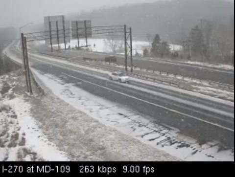
Snow accumulating on the roads in the #DC area, use caution traveling. Photo of 270 from Maryland DOT traffic cam:
9:30 a.m. EST Sunday:
Reagan Airport @Reagan_Airport Follow
A wintry mix is falling but no major impact to operations. Crews will treat our runways and roadways throughout the day.
7:15 a.m. EST Sunday: County official reports a thin glaze on exposed objects in Ansonville, North Carolina, with scattered slick spots on bridges and overpasses.
6:53 a.m. EST Sunday: A multiple vehicle accident has occurred on I-85 at mile marker 209 in North Carolina. This is just one of many accidents being reported by the 911 call center due to icy roads.
6:21 a.m. EST Sunday:
Of the several, snowy wkend o'night drives, this was easily the most challenging. Wouldn't go if not necessary #INwx
5:08 a.m. EST Sunday:
NWS Indianapolis ✔ @NWSIndianapolis Follow
4:00 a.m. EST Sunday: 7 inches of snow fell at Centralia, Illinois, NWS spotter reports.
3:39 a.m. EST Sunday: Freezing rain is expected during the next several hours in the Triangle of North Carolina, AccuWeather.com Meteorologist Brian Lada said.
2:52 a.m. EST Sunday: Snowy travel in the Cleveland area, ODOT webcams show.
2:20 a.m. EST Sunday: Icy conditions possible on I-80 from the Ohio/Pennsylvania line to PA Route 8 exit, 511PA reports.
1:49 a.m. EST Sunday: Snow continues to fall around the Indianapolis area, IDOT webcams show.
1:37 a.m. EST Sunday:
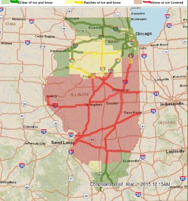
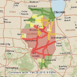
Many roads are snow/ice covered. Travel will be hazardous overnight. Visit http://www.gettingaroundillinois.com for updates. #ilwx
1:01 a.m. EST Sunday:
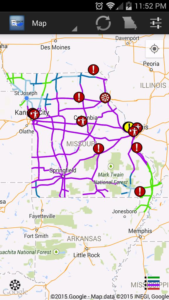
It's almost midnight & most of MO has roads covered by snow or ice=purple. Blue=partly covered. Green=clear.
12:06 a.m. EST Sunday: Light snow reaches Cleveland.
11:52 p.m. EST Saturday:
Hazardous travel conditions in many areas. Is your trip necessary? #ilwx













No comments:
Post a Comment